We woke in the morning on S.'s futon in Pacifica, California. It was a cool, foggy morning on the coast and we would have snuggled under the sleeping bag longer, but S. was up and ready to take us to breakfast.

S. lives in a small house that he has renovated about three blocks from the beach. I was really impressed with his bathroom renovation, for he had completely rebuilt the bathroom and it was beautifully done, with the claw-foot tub, and old fashioned fixtures. The original garage is now his bedroom and he has plans to add a sun room where the deck is now. S. is a very interesting person; he builds steam engines, has a restored Model A "woodie" and he grows Shitake mushrooms in his backyard. He also knows Bruce completely, and teases him about his perfectionist tendencies. "That's right, Bruce, get that crease just right, so you can jam it into a bag!" They are very good friends and I can hardly wait to have S. visit us here.

After breakfast, we visited the beach at the center of Pacifica. I was anxious to get on the road home, but N. was having a difficult morning. He was tired from his week at camp and he was needing to adjust to the noise and confusion of riding on freeways, being with adults (who talk as if he isn't there), and, especially to being with parents. We had debriefed the camp experience with him only a little and so he was reserved and what was meant to be gentle teasing on the part of S. and Bruce annoyed him tremendously. The beach was a good place for him--he worked out his frustrations by jumping from rock to rock on the breakwater. In the absence of his beloved swings, he had to find another physical outlet for his mood.

S. and Bruce, ambled along the waterfront, talking and teasing each other, sounding for all the world like they were still teenage friends. I let them be to themselves, and enjoyed trying out different features of my new camera by shooting pictures of the incoming tide, surfers and the shorebirds.
The cool, foggy air and the salt spray felt wonderful on my skin, and soon the half-an-hour turned into an hour-and-a-half. It was all to the good. N. got his tensions worked out physically and returned from the rocks at peace emotionally as well. Bruce had more time with S., and I had some down time alone with my camera. All was needed before the long drive home, where we would all be confined together in the truck for hours at a time.

We left Pacifica a little after noon, crossed the Bay on the San Mateo bridge and got to I-5 near Livermore by about 2 o'clock in the afternoon. I-5 runs right along the boundary of the Coast range and the Central Valley for about 60 miles south of Livermore.
The great water projects that make the Central Valley fertile can be seen from vista points along this stretch of the freeway. Water is pumped across the hills from the Sacremento River Delta, and then runs by gradient and pumping down the Central Valley from Sacramento to the Tehachipi Mountains, a distance of
 more than 300 miles. The irrigation canals cross back and forth across the immense valley. The energy and scale of this immense project is awesome to behold. We said the blessing that translates to: Blessed are You, Eternal our G-d, Creator of the Universe, who has endowed the human being with wisdom and knowledge."
 From the vista point, the immensity and fruitfulness of the great Central Valley can be seen very well. If not for the irrigation canals, and the hills under my feet, the lack of cornfields and the dry air, I could have imagined that I was in central Illinois, standing on the Bloomington moraine, which overlooks the immense flat farmlands to the south.
After the first hour of driving south, the mountains retreated to the west, and the highway followed the middle of the central valley. We drove past immense groves of fruit trees and fields of lettuce, strawberries and other fruits and vegetables. Somewhere between the exits of Merced and Fresno, we transitioned from Northern California to Central California. And at the California Route 46 exit, we left I-5 to turn east-south-east to Wasco and then Bakersfield. Tired of reading the infrequent entries in A Roadside Geology of Northern and Central California, I brought out a set of Lake Wobegon tapes, and we traveled across to Wasco listening to stories about farming and fertility told by Garrison Keillor. It was quite fitting, really.

As we turned south towards "Baker's Acres" as Bruce calls it, we began to notice that the sky was becoming dusky and smoggy looking. Bakersfield was in the thick of a dust storm, and when we stopped for gas there at about 5 o'clock, I took a picture of the red sun, still high in the sky. We all had that heavy depressed feeling that lack of direct sunlight gives New Mexicans, and Bakersfield did not seem like an appealing place to me and N. Bruce, who has been through there many times, said that he had never experienced a dust storm there before. He wondered aloud if it was an anomaly or if it was a seasonal occurence. We never did find out the answer to that question. As we continued southeast from Bakersfield toward Tehachipi, the thickness of the dust in the air began to dissipate, but it was completely gone until we crossed the Lone Wolf fault and begain to climb into the Tehachipi Mountains.
 These mountains are fault block mountains and they divide the Central Valley from the Mojave desert. They look quite a bit like the Sandia Mountains except that they are more rounded and the underlying igneous rocks are not as striking.
 For the second time that day, we saw the huge windmills that generate electricity. The first was in Livermore and now near Tehachipi. They are both projects out of Sandia National Labs, Albuquerque. We turned off Lake Wobegon so that Bruce could tell us about them. Although he is not in this area, several people who work on his floor do engineering for these wind farms.
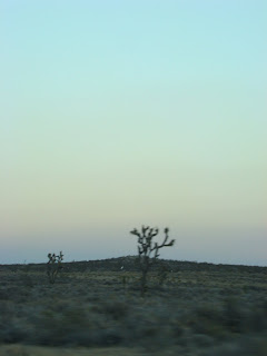
 As the evening rolled across the land, we descended across a fault zone from the Tehachipi Mountains and into the Mojave desert. This brought us out of Central California and into Southern California, so the Roadside Geology was no longer useful to us. And anyway, it was getting too dark to see the landscape we were traveling through. Even though the darkness deepened as we traveled southeast through Boron ("Gateway to Edwards Air Force Base--Landing site of the Space Shuttle!"), the temperature was climbing. Creosote and Joshua trees replaced the sparse Pinyon-Juniper woodlands of the Tehachipi. In Barstow, the truck thermometer read 95 as we caught the start of I-40. When we pulled into Needles, California at 10:30 PM, it was 103 degrees (F). We made two decisions: 1) Needles was a good stopping point for the night and 2) we would not attempt to camp because we were not acclimated to the heat. When we opened the doors to get out at the motel, it felt like opening an oven door.
 Our day had started in the cool, foggy air at 58 degrees (F) on Pacifica beach. It ended far to the south and east, in the Mojave desert air at 103 degrees (F).A big Change over a long drive.


No comments:
Post a Comment